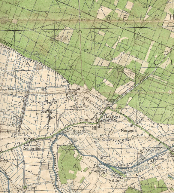
Maps - Hekkens
Feb, 1945
Supporting Information :
Description:
The providence of this map is not known and hence the pencil marks cannot be dated. However, the objective axis and start line are clear.
Tags:
Division History References :
The town of Hekkens on the southern edge of the Reichswald lay on the important intersection of the Gennep-Cleve and Kessel-Goch roads. It was also on the Siegfried Line and was therefore heavily defended with pill boxes. The town also sat on the proposed corps axis and therefore had to be cleared.

